
3D Scanning and Digital Recording Services

Construction documentation
We provide accurate as-built measurements and detailed 3D models of construction sites and existing structures. SLAM-based laser scanning plays a crucial role in construction safety, supporting Health & Safety file documentation and Building Safety Case data. Our services help ensure compliance while improving planning, project management, and long-term site documentation.
Versatility
Our mobile scanners perform exceptionally well in both indoor and outdoor environments, including large open spaces like warehouses and narrow, confined areas such as MEP rooms. With the ability to navigate multi-floor spaces and staircases, SLAM-based scanning is ideal for locations where traditional surveying methods may be difficult, hazardous, or inefficient. This technology provides a flexible and reliable solution for complex data capture needs.
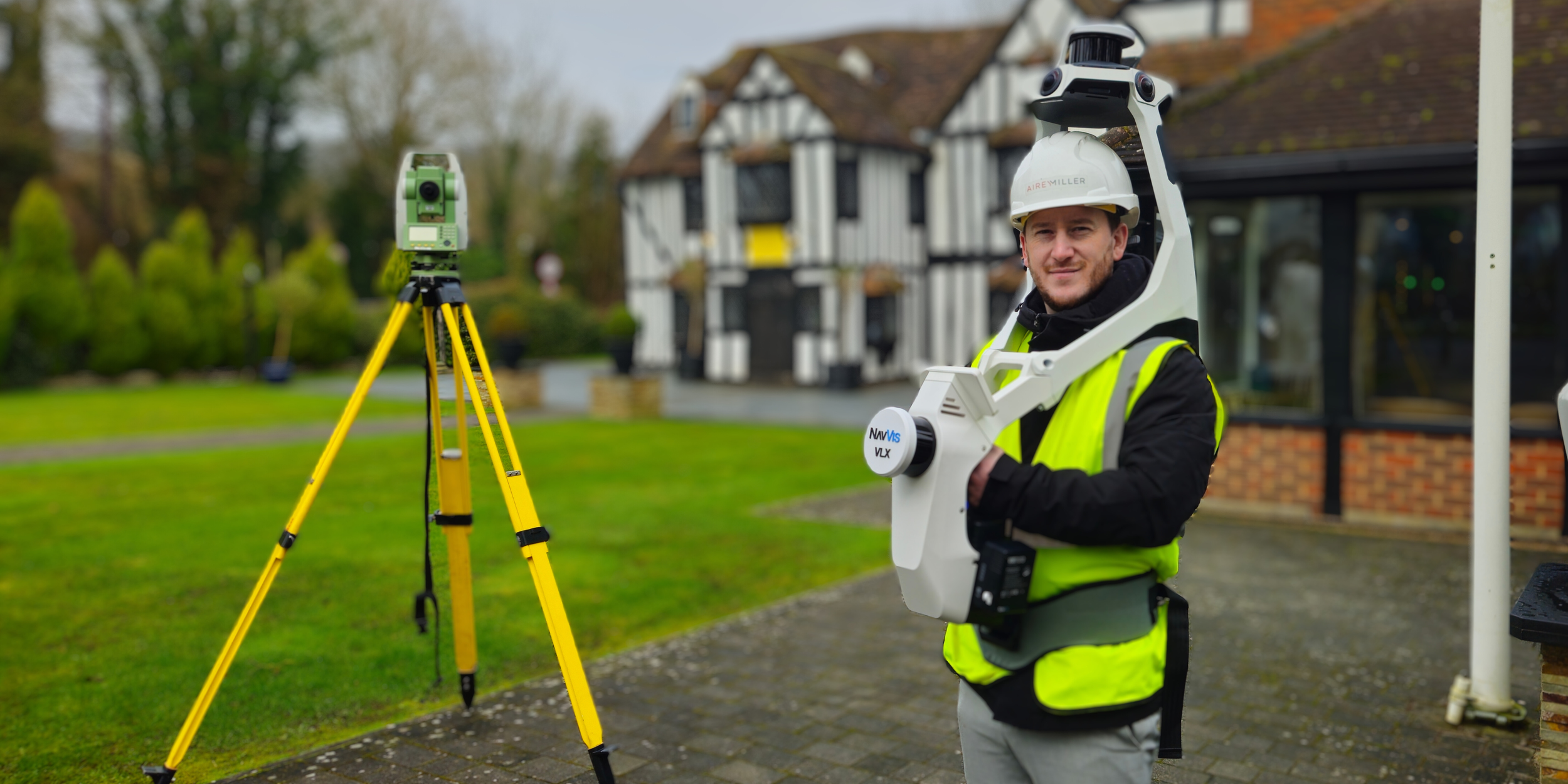
Portable scanning
Our mobile mapping systems, worn by operatives or mounted on drones, capture highly accurate data in real time. Using state-of-the-art LiDAR and SLAM technology, we efficiently scan environments while in motion. For projects requiring fixed-position accuracy, we also offer static scanning and total station services, ensuring precise measurements tailored to your needs.

Digital Asset Twins
We specialise in creating real-time, interactive digital twins that enhance operational efficiency, predict maintenance needs, and optimise asset performance. By integrating data from IoT sensors, operational records, and existing CAD models, we build comprehensive digital representations of physical environments. Our advanced modelling techniques provide businesses with predictive analytics, scenario simulations, and decision-making support, ensuring improved asset management.

Scan to BIM
Our Scan to BIM solutions use high-precision laser scanning to capture dense point cloud data of physical sites. This information is then converted into accurate, BIM-compatible digital models, supporting renovation, retrofit, and conservation projects. By providing detailed, data-rich 3D models, we enable stakeholders to make well-informed decisions and streamline project execution. Our expertise ensures seamless integration with all major BIM platforms.

Topographical mapping
SLAM-based laser scanning offers a fast and efficient way to produce detailed 2D and 3D topographical maps, even in challenging environments. Whether mapping streets, construction sites, buildings, or decommissioned naval vessels, this technology provides highly accurate representations of terrain and structural features. Our topographical mapping services support land surveying, infrastructure planning, and a wide range of geospatial applications.
Our wearable 3D laser scanner, complemented by NavVis IVION, excels in measured building and land surveying, helping produce detailed contour lines and elevation models. Its SLAM algorithm ensures accuracy of up to 5 mm within a 500 sqm test area, ideal for both built environments and terrains.
The technology we use integrates seamlessly with Auto Desk and topographic mapping software, enhancing surveys with efficient yet accurate data capture. Survey control points bolster this precision, facilitating the creation of 3D models, terrain maps and topographic drawings.
Explore Your Building Digitally
Step inside an immersive digital walkthrough. Navigate your building remotely, understand layouts and spatial context, and take accurate measurements directly within the space, supporting informed, confident decisions using a reliable digital record accessible anytime, anywhere.